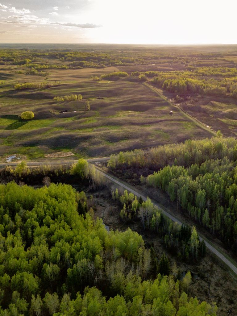
A variety of local attractions are available within easy driving distance of Coyote Lake Lodge. Our guests may wish to visit local rural communities, and agricultural landscapes or learn about the region’s cultural histories. At Coyote Lake Lodge we focus on the healing power of nature and on nature conservation. This is why our land is posted for no trespassing and no hunting – live wildlife is more valuable to our guests. Lakes, rivers, and forests support a wide variety of ecosystems at the intersection of the Foothills, Parkland, and Boreal Forest Natural Areas resulting in an area of rich biodiversity.
Our guests can also take regional trips while using our accessible lodge as their base. Coyote Lake Lodge is located at 53°17’08” North, 114°30’29” West, within an area that stretches from Edmonton to the Rocky Mountain foothills. This region has a long list of attractions that, some would say, culminate in Jasper National Park. The North Saskatchewan River was traveled by Indigenous peoples, early European explorers, fur trappers, buffalo hunters, loggers, and then agricultural settlers. Railways, roads, and airports followed. Today, our region supports agriculture, petroleum, coal mining, forestry, and tourism.
Below are a few of the regional attractions that we recommend to Coyote Lake Lodge guests.
Within 0 to 10 km


Features of Nature: Coyote Lake is surrounded by land owned by the Government of Alberta and the Nature Conservancy of Canada. The lake is about 150 km² and is too shallow for the overwintering of sports fish. Beaver and larger mammals are common but it is the summer birds like loons, geese, ducks, and herons that capture the attention of visitors. The North Saskatchewan River supports a forest landscape of poplar, birch, white and black spruce, and larch, interspersed with creeks and small wetlands. Land patterns reflect past forest fires and agriculture.
Recreation destinations: Coyote Lake Nature Sanctuary, a nearby conservation area owned by the Nature Conservancy of Canada, is a bird watcher’s paradise with over 150 summer species.
Communities: None
Industries: Electrical power lines and petroleum-producing fields and pipelines cross this area. Gravel extraction is active along the North Saskatchewan River. Ranching is common.
Within 10 – 25 km

Features of Nature: To the east and south, forests have long been replaced by agricultural land.
Recreation destinations: There are dozens of Alberta conservation areas with some amenities. A golf course is located west of the lodge at Birchwood.
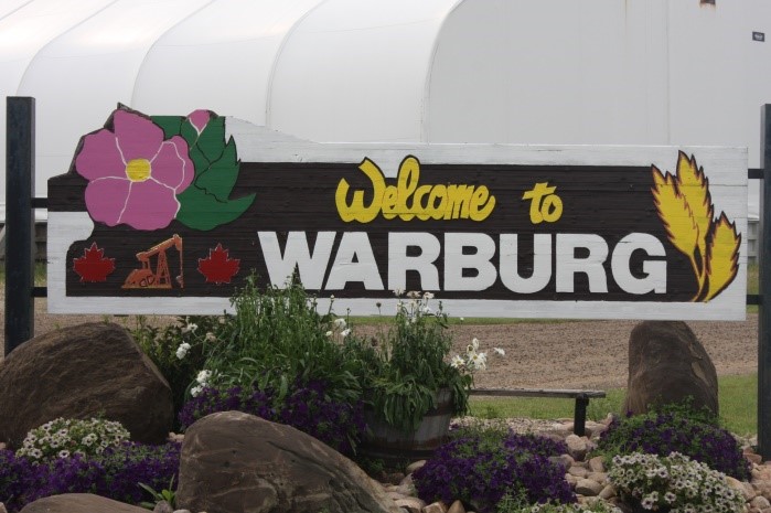
Communities: The small communities of Tomahawk, Telfordville, Sunnybrook, Warburg, and Breton all have roots in agriculture. Breton was originally settled by African Americans from the southern United States. The Warburg Hutterite Colony is a thriving agriculture enterprise and is recognized by visitors for sale of agricultural products.
Industries: Genesee and Keephills electrical power plants have been powered by surface-mined coal and recently converted to natural gas.
The hill country, where the lodge is located, descends to the east of St Francis to flat agricultural land that supports grains and canola and, to a lesser extent, fields of peas, potatoes, and other crops. Family farms have been consolidated and small areas of forest are still being cleared. Fields are usually described in terms of quarter sections (i.e. 160 acres).
Within 25 – 50 km


Features of Nature: To the west and north forests are still extensive.
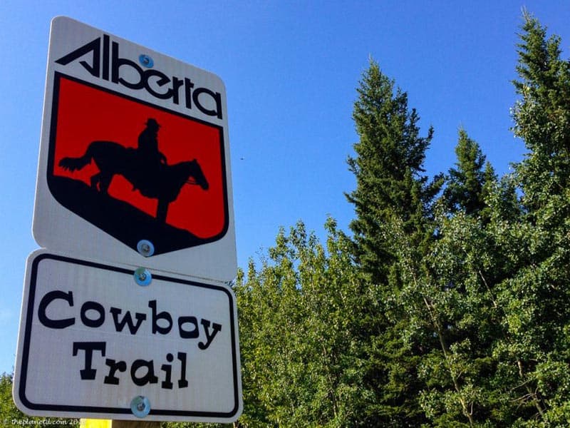
Recreation destinations: Extensive summer cottage areas surround Pigeon, Buck, Isle, and Wabamun Lakes. The Cowboy Trail highway follows the Regional Municipality of Foothills to southern Alberta.
Communities: To the east, Thorsby, Calmar, and Stony Plain, have agricultural roots, and, to the west, is Drayton Valley which has a great farmer’s market.
Industries: Drayton Valley developed from the forestry and petroleum industries. Agricultural land is common in the north and south and especially in the east.
Within 50 – 100 km

Features of Nature: Forests to the east have long been cleared for agriculture. To the west, the foothills are dominated by pine and spruce forests. The North Saskatchewan River drains much of the area.
Recreation destinations: Several large waterbodies, including Brazeau Reservoir, Lac St. Anne, and Gull Lake, attract summer residents and visitors for watersports and fishing opportunities.
Communities: Administratively, this area includes several counties, the cities of Leduc, Edmonton, St. Albert, Fort Saskatchewan, Spruce Grove, and Sherwood Park. The Edmonton International Airport (YEG) is the link to the world.
Industries: Infrastructure for urban communities dominates the northeastern side of this area. To the south is agricultural land. To the west is forestry. Petroleum infrastructure of wells, pipelines, and processing plants dominate the landscapes.
